Jackie and I have continued to work up toward being able to take our planned very long walk in mid-June.
Our previous outing was planned for 15 miles, but we actually did about 17. For yesterday’s outing we came closer to hitting our target distance—planned for 20 miles and came in at 20.61 miles.
It was a pretty good walk. The temperature was a bit cool, but stayed steady for the duration, so we weren’t having to adjust clothing repeatedly.
We walked through Robeson Park and then to our old neighborhood where we had lunch at El Toro. Then we went up the Greenbelt Bikeway and visited our old garden plot near Parkland College. Then we angled our way to downtown Champaign, passing near both our summer place and our winter palace, pausing for coffee at Pekara Bakery. Finally, we walked to the University of Illinois Arboretum (where the cherry trees were just blooming) and then headed home through south campus and the research park.
We held up pretty well, perhaps because the distance was only 3 miles beyond our previous long walk. My plan is that we’ll do 26.2 miles for our next walk, sometime towards the end of April, but we’ll see how things go. We have time in our schedule if we want to take that jump in two steps.
We haven’t been getting in as many of the medium walks as I’d hoped, mostly because of problematic early-spring weather. With the weather shifting to more of a late-spring pattern, I’m hoping that won’t be a problem going forward.
One thing I’d like to do is start including some faster miles in those medium-length walks. We can walk fast enough, but we tend to slow down late in the walk. That’s fine, but if we have very many miles at 20+ minutes per mile, it will make for a very long day on the Kal-Haven trail.
Jackie recently expressed a concern related to my expanding interest in fitness: “We were both nerds together at Motorola, but now you seem to be turning into a jock.”
I assured her that she was mistaken, pointing out that I have no new interest in team sports, nor in spectator sports—two key markers for jocks in my mind.
But I did see how she might be concerned. I was putting a lot of time, effort, and attention into this fitness stuff. I was also writing about it and taking about it a lot. (Enough that I felt I had to move some of the writing to my Esperanto-language blog, where it would bore fewer people.)
Most recently, I’ve been looking at some Natural Movement stuff, in particular at MovNat. They have roots in the same source as parkour, but without the urban bias. They also have a broader perspective—parkour is all about getting from point A to point B, dealing with obstacles as efficiently as possible. MovNat is about rediscovering a broader range of human movement skills—not just running, jumping, climbing and balancing, but also throwing and catching and swimming and diving and fighting.
Aware of the fact that I’m in that brief phase where some new thing is all shiny and interesting, I try not to spend all my time talking about it, but I still talk about it enough to bore any ordinary person. (Jackie recently let me go in for some minutes about one of these things and then said, “You should write something about this on your Esperanto blog!”)
Yesterday, while we were out on our long walk, I was once again going on about this or that aspect of movement skills. Jackie listened patiently, then said, “I take it back. You’re not turning into a jock. You’re becoming a geek about parkour.”
Today was our nicest day of the year so far, and Jackie wanted to do another long walk, so that’s what we did.
It seemed kinda early for a long walk, just 4 days after our last long walk. It was also kinda soon after my little parkour adventure yesterday. But the weather was great.
I had rather expected to be too sore after yesterday’s parkour—and I had noticed in the night that my core muscles were pretty sore.
Did you know that your core muscles are critical to turning over in bed? If not, I invite you to spend an hour on quadrupedal motion, precisions, and vaults, after which (unless you’re already a highly trained traceur) I’m confident you’ll be able to observe the fact for yourself. But when I got up, I discovered that I was otherwise fine. My feet, ankles, knees and hips were all fine, as were my calves and thighs. So, if Jackie wanted to do a long walk, I was okay with that.
We did it on kind of a whim, so we didn’t have a route planned, but that was fine: We just winged it. Today was a taiji day, so we started by walking to taiji. After taiji we walked to campus, where we decided to eat at Ambar India on campus—it’s a buffet, so we wouldn’t have leftovers to deal with. Then we walked to the Nutritional Food Store, the only place we know of to get freshly ground peanut butter. Then we walked home.
It came in at just under 13 miles, but we were tired enough and sore enough to not want to walk another couple of miles around home just to hit the 15-mile mark. We’ll do that later in the month, closer to the planned time. (Instead we sat out on the patio and drank beers. It was the first day warm enough for patio sitting this year, and we enjoyed it a lot.)
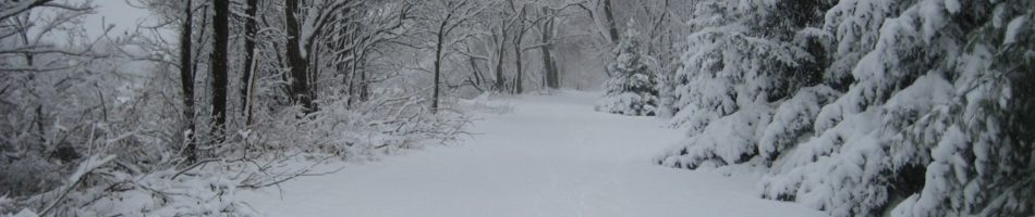
I went for my first outdoor run of the year on Sunday. It was the first day that the paths were clear enough of ice and snow to make it possible.
Although the paths were mostly clear of ice and snow, there was a lot of melt water, flowing across the path in hundreds of rivulets. I found myself integrating into my run hundreds of small leaps, in a (partially successful) effort to keep my feet dry.
I was well aware of the leaps as I did them—I remember making a conscious effort to refrain from favoring one side over the other, trying to execute each leap with the most natural foot leading, based on my current point in my stride as I approached.
For some reason, all those leaps were not the first thing that came to mind the next day, when my calves were as sore as they have ever been. I was just sad at how much more out-of-shape I must be than I had realized, to be so crippled by a simple three-mile run. (They hurt a lot more than when I actually tore a calf muscle a couple years ago.) It was only late Tuesday, when I was heading to teach my taiji class, that I jumped over a similar stream of water in a parking lot—one calf screaming when I launched, the other screaming when I landed—that I realized that it was the leaping that had done such a number on me.
With that reassurance I felt much better, and by Wednesday my calves were feeling much better, which was good because Wednesday Jackie and I went on our first long walk of the year, part of the series of long walks we’re taking to prepare for the 33.5-mile Kal-Haven Trail walk that we’ve been meaning to take for a couple of years now. We’re quite determined that this will be the year.
For our first long walk we walked to taiji, attended our class, and then walked on to downtown Urbana and had lunch at Crane Alley (good beer). After lunch we walked back through campus. Having exceeded our planned distance (we wanted to do 10 miles and got in 11.5), we caught a bus at the south end of campus to go the rest of the way home. (The walk home from the south end of campus isn’t far, but there’s no good footpath. I think during the summer, when it’s possible to walk along the side of the farmer’s fields, it’ll be a fine walking route, but yesterday it would have been too wet and muddy.)
It was warm enough that I was able to expose my forearms to the sun!
My training plan, such as it is, covers just the long walks—we’ll include many shorter walks in our daily activity, and plenty of medium walks as well. But the long walk plan looks like this:
first-half March: 10 miles — done
second-half March: 15 miles
first-half April: 20 miles
second-half April: 26.2 miles (because why not?)
first-half May: 30 miles
The main event is planned for roughly June 18th, but it will depend on the exact schedule of when we go to visit my dad and what the weather looks like those days. I figure we’ll be fit enough to do a very long walk of the planned distance any time after mid-May, so that gives us a month’s cushion to allow for any glitches.
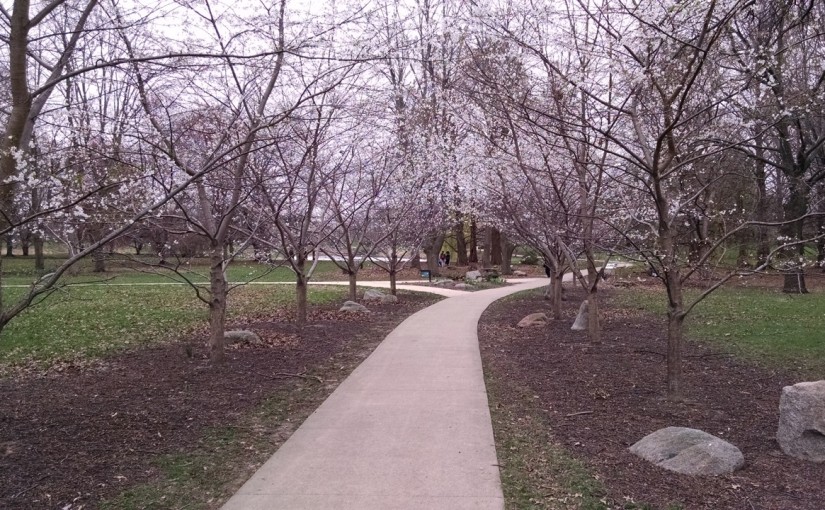
I’m kind of excited about possible medium-length walks from our new house, here south of town. All of south campus is reasonably close, including, for example, the Arboretum with its cherry trees, which should be in bloom in about a month. It might make sense to walk there several times in early April, to keep up with the progress of the cherry blossoms, and take the opportunity for both haiku and photographs.
The most obvious way to walk (starting with the exact route from south Campus that I rejected yesterday) would be about 3 miles each way, the first half along the sides of country roads. As I say, it should be an entirely satisfactory route anytime the ground isn’t too wet.
We have a bunch of things we’re hoping to do this year, and most of them require some amount of preparation—preparation which will have to occur in the winter and spring.
As preparation for that, I really want to spend half an hour almost every day practicing my Esperanto. That should be plenty—I already read and write the language and I’ve attended international Esperanto gatherings in the past. But just a bit of practice listening to spoken Esperanto (podcasts and such) and a bit of practice actually conversing (with my local Esperanto group, and such other folks as I can find) will go a long way toward making attending this kongreso a rich and satisfying experience.
About a month before that will be the solstice, and right around then—second half of June or very early July—is the only good chance do the Kal-Haven trail walk that we’ve hoped to do each of the last two years. (In those weeks because only then are the days long enough to finish the walk in daylight.)
As preparation for that, we need to go on several walks each week, including a very long walk roughly every other week, working our way up to being able to walk the 33.5 mile trail.
Several months earlier—just one month from now—we’re going to have a little party for people to come see our townhouse. We’ve fixed the date as February 1st, and are thinking of it as a celebration of Groundhog’s Day Eve, or Imbolc, if you prefer. Invitations are forthcoming. If you don’t get one, it is surely an oversight—let me know.
As preparation for that, we need to finish unpacking!
Without a specific deadline, but very soon now, I want to finish revising my novel so I can get it out to first readers.
As preparation for that, I need to spend an hour or two every morning writing.
Normally at this time of year we’d also be planning our garden, but Jackie has convinced me that working a garden plot this summer will be more than we can manage.
We’re just about there. The Kal-Haven trail is 33.5 miles, and yesterday we walked 23.3.
My plan had been “more than 20,” and we managed that, although we went a bit over.
It turns out to be surprisingly hard to plan a route with a very specific distance, if you want the route to be interesting. (It would be easy enough if you were willing to just map about a 2-mile loop and walk it 10 times.)
We did pretty well in the past using Google Maps to plan a route, entering waypoints and then going in and tweaking Google’s suggested route to match what we knew we were going to want to do. I did that again, but with a walk this long, I ran into some limits I don’t remember hitting before. In particular, there seems to be a 10-waypoint limit, and those “tweaks” to the route seem to use up waypoints. I don’t know if that wasn’t true with the old Google maps, or if our earlier walks just didn’t need more waypoints than that.
Without being able to tweak the route to match what we were going to do, I just entered points of interest for each of the corners of our walk, then fiddled with them a bit until I saw that we were at 20.1 miles. Then I figured we could just adjust it on the fly. It almost worked.
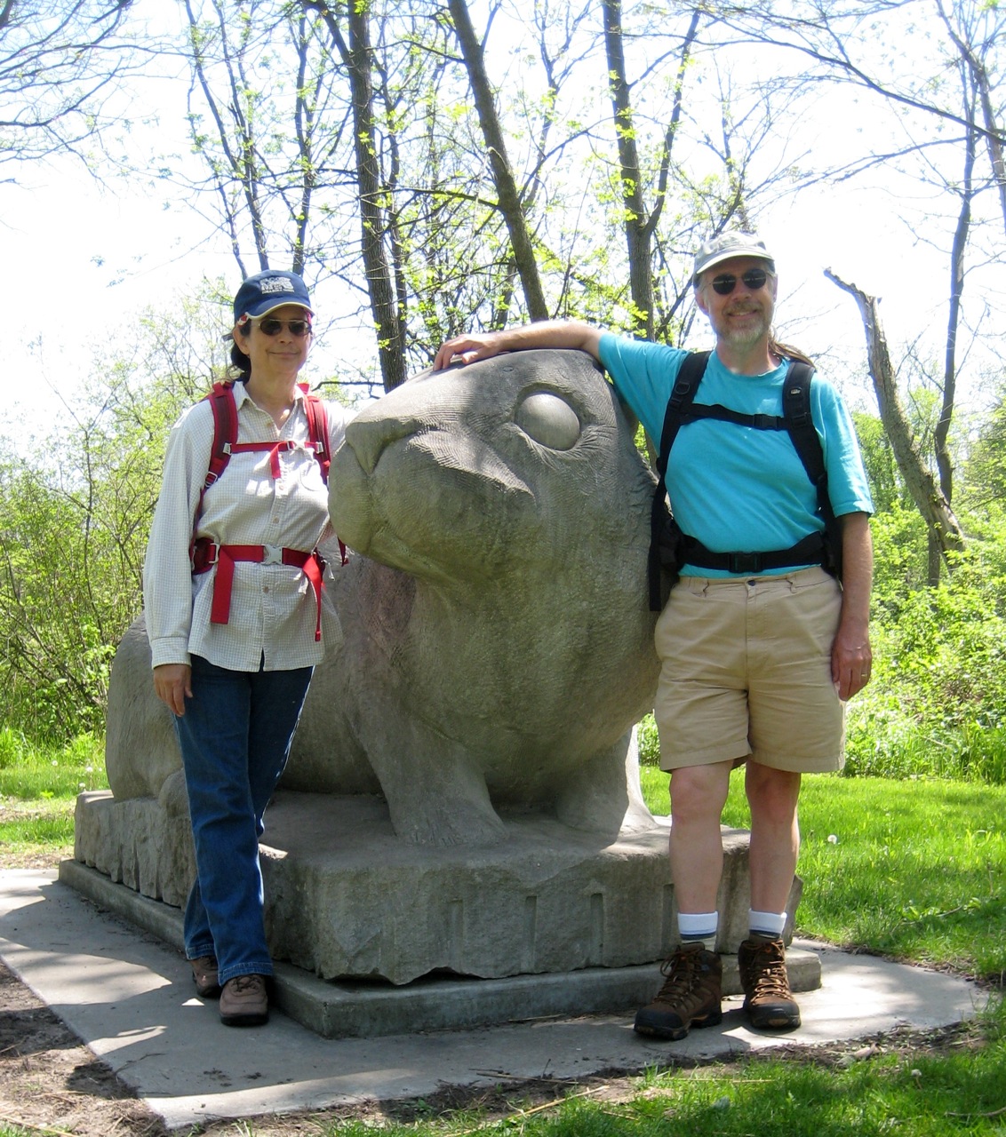
The route was pretty similar to our longest walk of last year, except that we’ve decided to carry our lunch on the trail, so we skipped the leg to Milo’s Restaurant. We walked to the Olympic Monument near Parkland College, then to Busey Woods (via downtown Champaign and Crystal Lake Park), then to Meadowbrook Park, where we had our lunch at the Prairie Viewing Platform. (We paused shortly after to get the above picture of us posing with the giant rabbit sculpture.)
The other place I particular thought we ought to stop was Triptych Brewery, which we’d never made it to before, even though they’ve been there for a year. (We go almost right past it several times a week—in particular, when she walks home from taiji class, Jackie passes just three or four blocks away—but always in the morning when it seems a little early for beer, and anyway they’re not open.)
It wouldn’t be a long walk from Meadowbrook to Triptych, if you wanted to walk along Windsor Road, but that sounded unpleasant. Instead we hiked north up Race and then cut across through married student housing and the arboretum, took Hawthorn through the research park, crossed the railroad tracks at St. Mary’s, and then headed back south on the Boulware Trail. That probably added a good mile to our route.
We made it to Triptych around 4:00 PM. The joint was hopping, which was good to see. They had about 10 beers on tap. Jackie had a honey basil blonde ale, which she liked very well. (The honey and basil were very subtle, she said.) I had their dry Irish stout, which was also excellent.
As we were passing through the research park, we’d calculated the distance we were going to end up walking (because of her walks from taiji, Jackie knew just how far it would be from Triptych to home), and we knew we were going to come out over our planned 20 miles. But we really wanted those beers, so we decided to just take the most direct routes and hope for the best. And it worked out fine.
The first 5 miles over our previous very long walk was no problem. After that, things got kinda tough—we were tired and footsore—but there was never a point where we worried that we might not make it. If you’re interested, Endomondo has the GPS track and details. (Ignore the altitude data. When the phone loses the GPS signal, it often inserts a point with an altitude of zero. However, no point in Champaign County is at sea level.)
In my report last week on our previous very long walk, I mentioned that my plan for after the 20-mile hike would be a 25-mile hike. Almost as soon as I’d posted that, I realized that obviously our next hike should be 26.2 miles. Duh.
The Illinois Marathon passes just a few blocks from our apartment. The closest point is very near the midpoint of the race.
I grabbed the map off their website, and figured we could just walk to the nearest point, pick up the route there, walk it until the finish line, cross over to the starting line (just a block or two from the start) and then carry on until we get back to the midpoint, and then go home.
It’s not a plan yet. More of an intention. Maybe just a notion.
Today we’re going to rest, have a mother’s day lunch with Jackie’s mom, and take her out for something fun. Maybe a walk in the woods, or maybe (if the predicted rain arrives) to the art museum.
Jackie and I have gotten back to our very long walks.
Last Saturday we went to Lake of the Woods and cobbled together their 5-mile prairie trail and their 3.3-mile bike path (together with a couple of jaunts down maintenance roads) into an 11-mile hike. (My goal had been “more than 10 miles.”)
It was great.
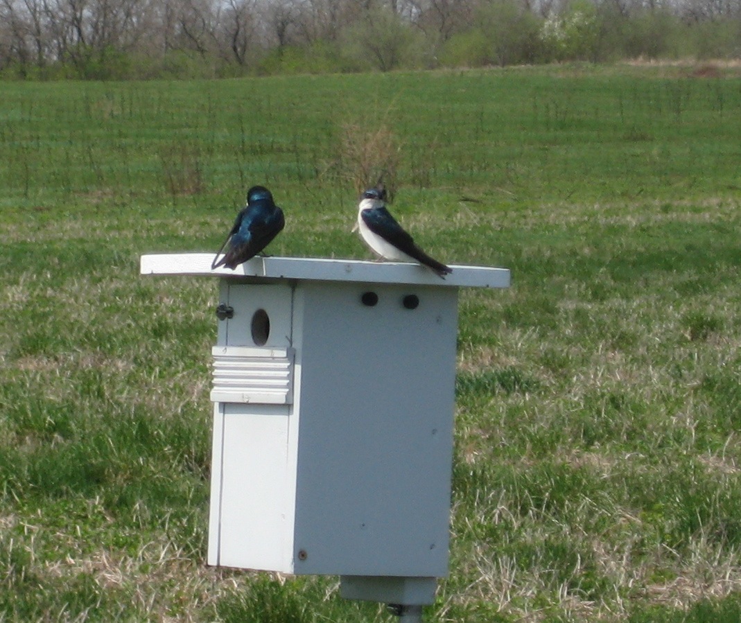
The prairie was full of these bluebird houses that had been occupied by tree swallows.
The tree swallows daunted me briefly; I don’t remember having seen the species before (although I must have). I spent the whole prairie phase of our walk staring at them, thinking “They’re not bluebirds. They’re not indigo buntings. They’re not purple martins,” over and over again.
I’m sure they weren’t the only interesting species I saw, but they’re the only one that comes to mind now, a week later.
We parked near the Museum of the Grand Prairie, and ate our snack in the botanical garden, which brought to mind the day Steven and I bicycled to Lake of the Woods, which I’d remembered as last year, but which turns out to have been in 2011.
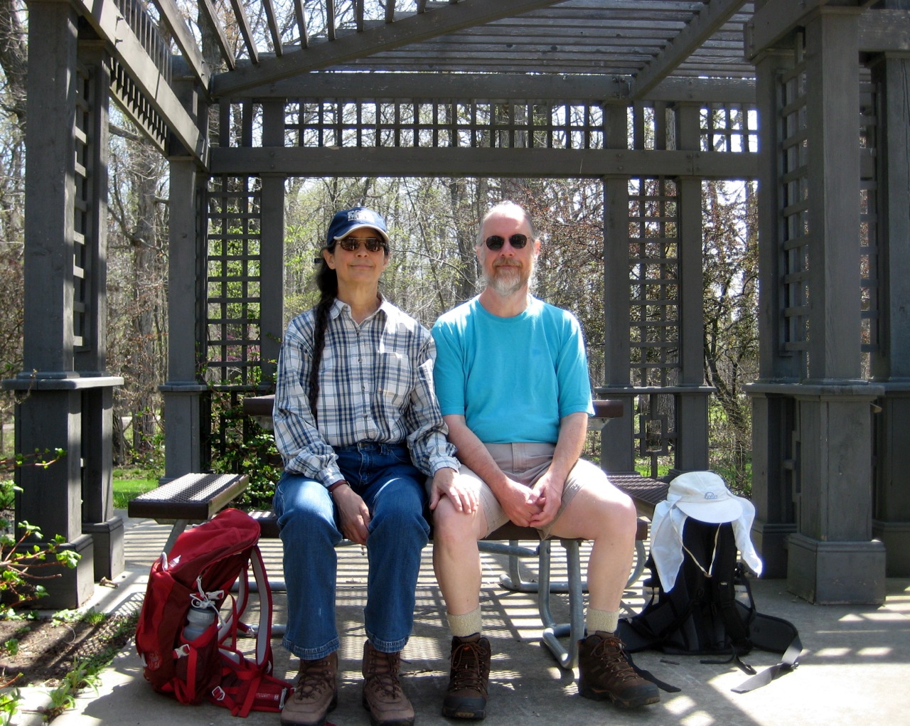
I’d earlier gotten a picture of Jackie and me at the picnic table where we’d later have our snack. I like to think of it as a modern reinterpretation of the Victorian portrait.
Yesterday we did a longer hike. My goal this time was “more than 15 miles,” and we each hit it, although we separated around mile 13, after swinging by the Student Union in time for me to attend my Esperanto meeting. Jackie went on home after drinking some iced coffee. I stayed to speak some Esperanto, then walked on through the water amenities, downtown Champaign, and West Side Park.
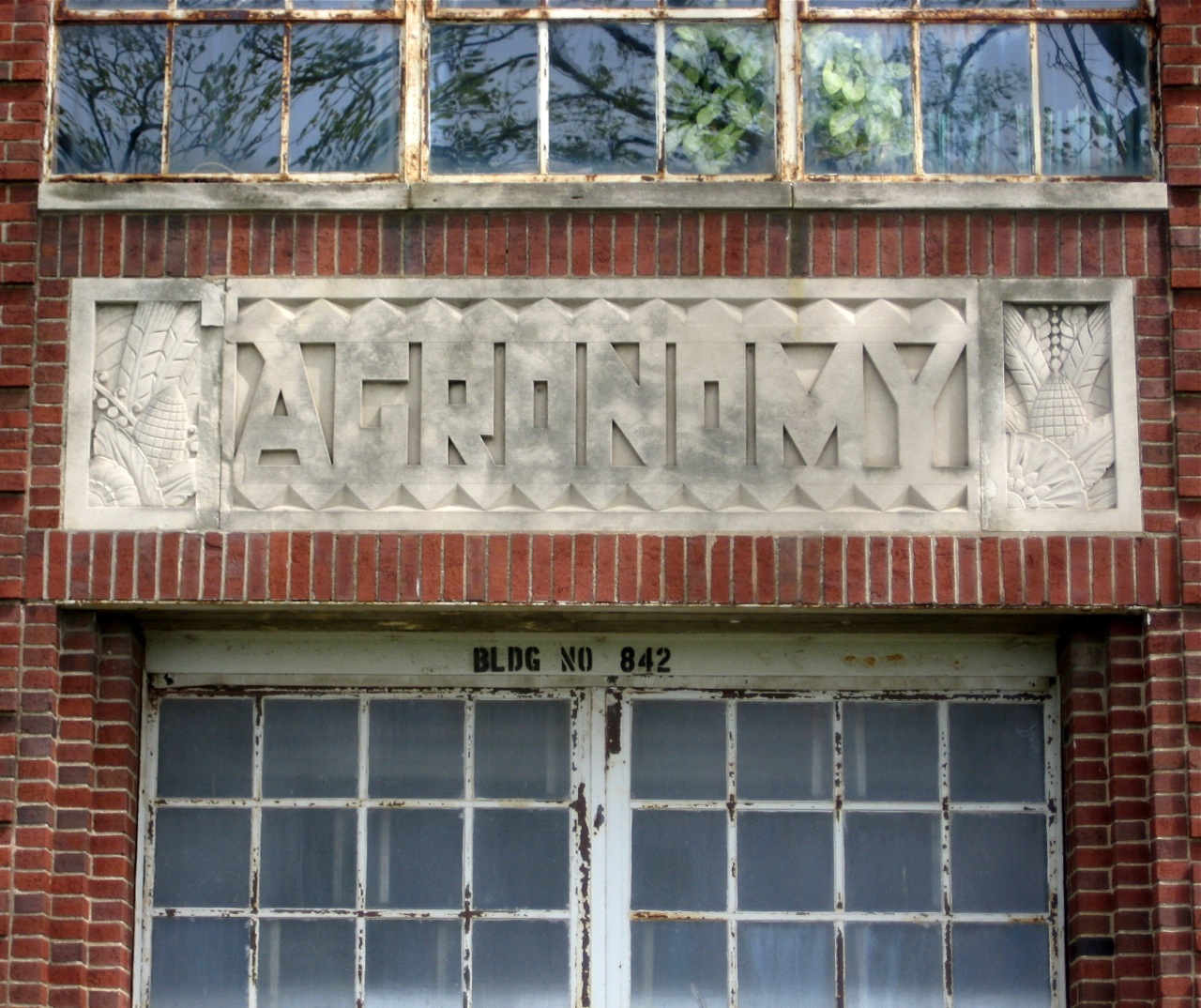
Along the way we passed the university’s Agronomy building. We’d passed it a year ago, and I’d neglected to get a picture of the name over the door, and very much regretted it ever since. So this time I made a point of pausing for a photo-op:
I like the harvest iconography on each side of the name. Very handsome.
To do the whole 33.5 miles during daylight, we’re going to have to set a pretty good pace.
Last summer we did okay when we didn’t have to spend too much time fiddling with things. (It’s surprising how many things need to be fiddled with on a long walk—socks, boot laces, packs and their contents, water bottles and the refilling thereof, intersections both with and without pedestrian walk signals. The list is all but endless, and on more than one hike it seemed like something needed to be fiddled with on virtually every mile, such that we’d get home and look at our speed and remember, “Oh, yes. That mile was slow because we stopped to get a snack, and that mile was slow we had to reapply suntan lotion, and that mile was slow because we stopped to use the restroom. . . .”) When we didn’t stop to fiddle with something, we often finished a mile in not much over 18 minutes, even late in a hike. However, even when we hustled right along, we never broke 18 minutes all summer long.
Last week we did do a sub-18 minute mile, and when we started out yesterday, our first mile came in under 18 minutes again. We were pleased with ourselves and decided to pick up the pace a bit more, and managed to beat our time for the second mile, and then again for the third. By then we were all warmed up and covering a stretch of the route where there was almost no interaction with traffic, so we decided to push the pace a bit more, and managed to do a sub-17 minute mile, which is pretty darned fast walking.
Here’s the Endomondo track of my version of the walk (Jackie’s is the same until we separated along about mile 13):
Up to now, we’ve pushed the distance rather quickly, since we’re just recovering distance that we were doing easily enough last summer. Our next walk, which will be around 20 miles, will be a new “longest walk ever” for each of us. After that, we’ll want to do perhaps 25 miles in late May and then the same (perhaps slightly more) in early June. I think that’s as long of a training walk as we’ll need to do. The whole point is to make 33.5 miles a special effort, something that would be undermined by doing the whole distance in training.
Jackie and I did another of our very long walks yesterday, going 18.25 miles. We hope to go even farther in a walk in a couple of weeks (we’re tentatively thinking 20 miles), but that will probably be the last time this year that we do a new longest walk ever, simply due to limited daylight as the year winds down.
Like the last couple of very long walks, we stuck with Milo’s as our lunch destination. If you go the shortest way possible, it’s about 14 miles there and back. We were aiming for a bit over 17, so we had to add some short side trips to get the length up. We went by way of the research park and had coffee at the iHotel, went through Meadowbrook Park, and then after lunch briefly visited Crystal Lake Park as well.
I’ve brought my camera on almost all of these walks, but have hardly taken any pictures. This time, I took some pictures.
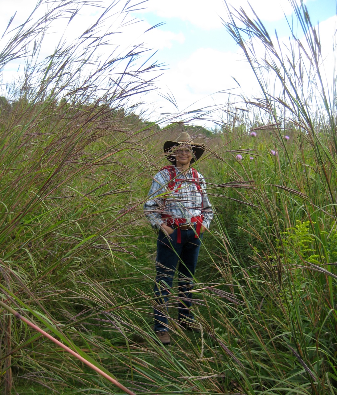
We’d walked through Meadowbrook Park on a couple of our previous walks, but usually after lunch. This time we did Meadowbrook Park before lunch—and we walked the prairie path, rather than taking the paved paths through the sculpture garden.
It was fun to see Jackie through the big bluestem.
Jackie in the prairie at Meadowbrook Park
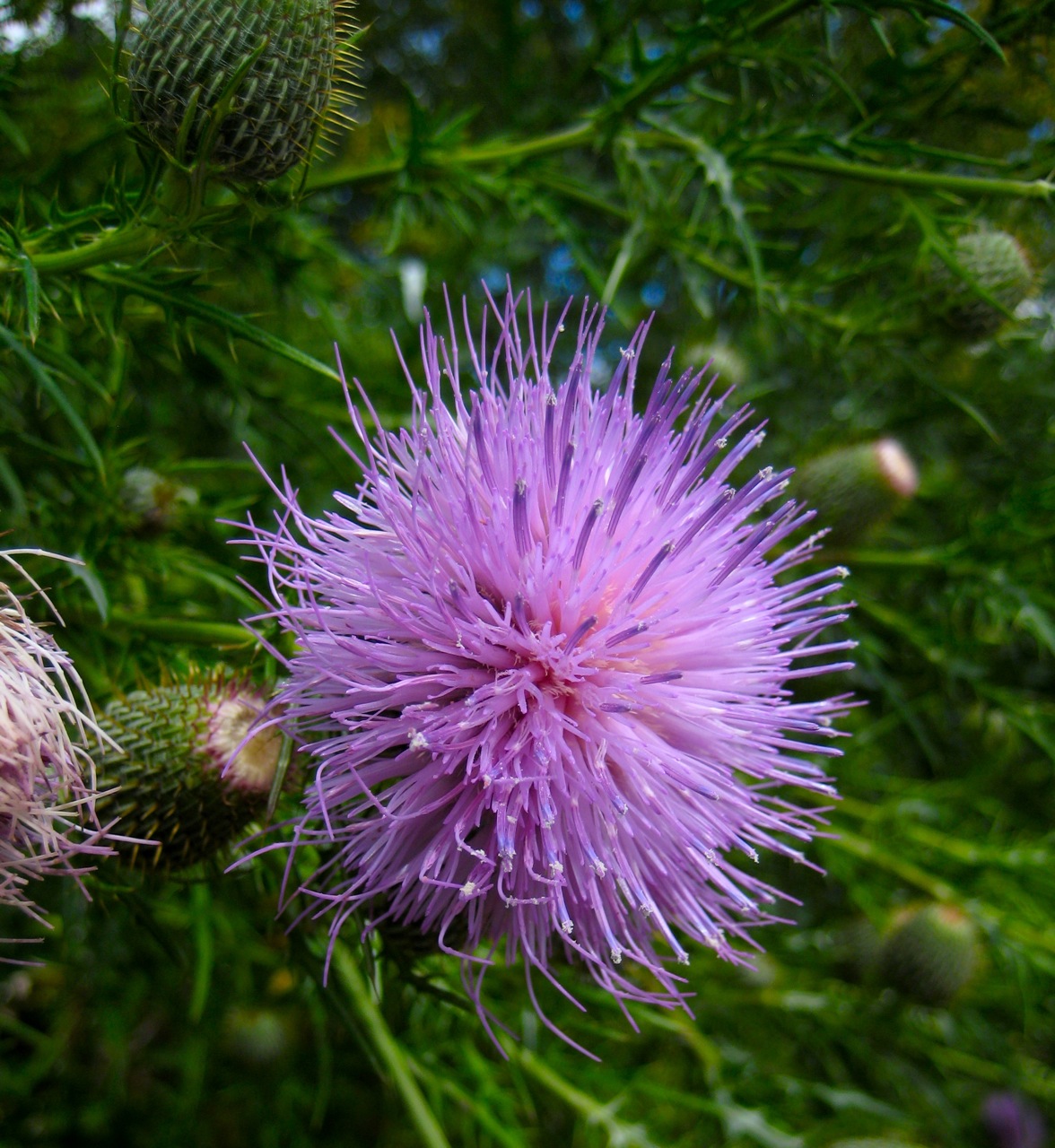
I was also pretty pleased with this picture of a thistle flower, taken just a few yards further down the path.
Thistle flower in the prairie at Meadowbrook Park
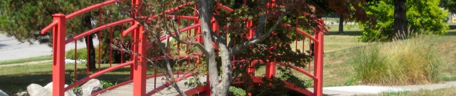
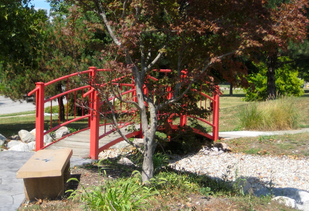
After lunch we proceeded toward Urbana, passing through the neighborhood where Jackie used to live before we started dating. One feature of that neighborhood is a little Japanese Garden. Jackie and I used to visit it pretty often. Eventually the last couple of reasons to visit that neighborhood vanished, and we quit going. I was pleased to get there again, although a little sad to see that they’d given up on the water features, and instead filled the pools with gravel. It’s not the same.
The red bridge at the Japanese Garden near Sunnycrest
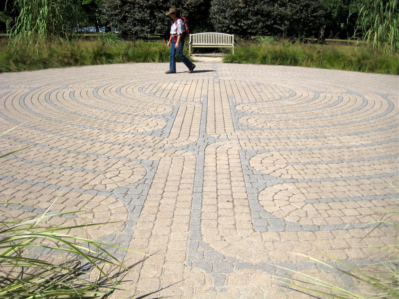
We also did a preposterous thing. In the midst of our very long walk, we paused to walk the labyrinth in Crystal Lake Park. (Endomondo did not seem to give us credit for this extra walking. I suppose at the level of precision possible with GPS, someone walking a labyrinth looks an awful lot like someone sitting at a bench.)
Jackie walking the labyrinth at Crystal Lake Park
For those who are interested in such things, here’s the data on our walk, via Endomondo:
I got a great comment on my previous post (thanks Ilana!), and started to reply in a comment there, but realized that I was straying into something that I wanted to talk in a post—training cycles that aren’t a multiple of 7 days.
Rereading my post, I see that it does look like my only runs are my long run and my fast run. That’s not the case, though. I try to include two or three easy runs each week as well.
In years past, my training schedule was pretty ordinary. Each week would include a long run and a fast run, each followed by a rest day. The other three days would each be a chance for an easy run. I found that I could just about maintain my fitness if I ran three times a week, but that I had to run four or five times a week if I wanted to improve either my speed or my endurance.
This summer my training routine has been complexificated by these very long walks I’ve been doing. It turns out that I need about two days to recover from a walk that pushes beyond the farthest I’ve ever walked before. Adding a long walk and one or two recovery days to my usual schedule pushes it out to a 9 or 10 day cycle, instead of a 7-day cycle.
The obvious thing to do would be to create a 9-day cycle—something like this: long walk, rest day, easy run, easy run, long run, rest day, easy run, fast run, rest day. One obstacle to that is that the various tracking tools I’m aware of all provide summaries for weekly periods, not for 9-dayly periods. (If you know of an exercise tracking tool that can produce useful summaries for training cycles of arbitrary length, let me know.)
So, I’m just winging it as far as a training schedule goes. Since it became clear that we wouldn’t get to Kalamazoo for the Kal-Haven trail walk this summer (we’re now hoping to do it next summer), we’ve eased up a bit on lengthening our very long walks, although we’re still planning to do 17 miles shortly. At these distances, it seems like doing each “even longer” walk ought to happen only every other week (with the long walk on the alternate weeks being comfortably within our established capability).
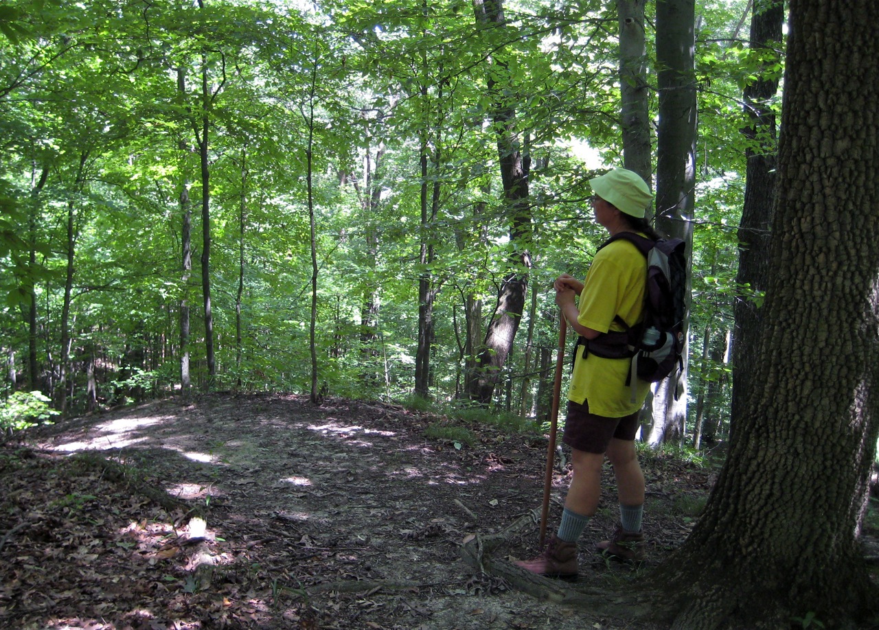
Jackie and I went for a hike at Forest Glen today.
There was a Spinners and Weavers Guild event there, and our plan was to go early, go for a hike that would take 4 or maybe 5 hours, and then get back in time for a late lunch and a couple hours at the event.
Turns out, our timetable was a bit optimistic.
For one thing, having failed to get all packed up the night before, we left an hour later than we’d intended. Plus, getting to the venue took a bit longer than we’d planned. So, instead of starting our hike around 8:00 AM, we didn’t hit the trail until about 9:15. On top of that, our hike ended up taking a full 6 hours, instead of the 4–5 we’d planned.
Our socializing after ended up being with just the last 6 or so die-hard spinners.
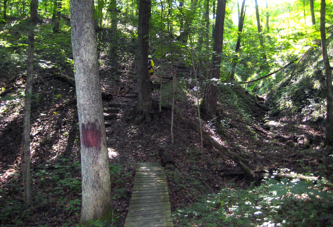
Jackie climbing a ridge.
Still, it was a great hike. Unlike our urban walks, Forest Glen is non-flat.
It’s kind of hard to see in that picture (click through for a larger version), but Jackie is there right in the middle, hiking up the side of the ridge.
There’s not a huge amount of elevation change, but the trail makes good use of what there is. According to Endomondo, we stayed between 407 and 644 feet above sea level, and yet we managed a total ascent of 1330 feet and a total descent of 1287 feet.
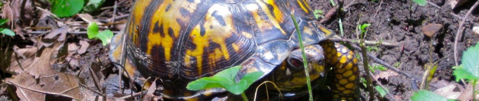
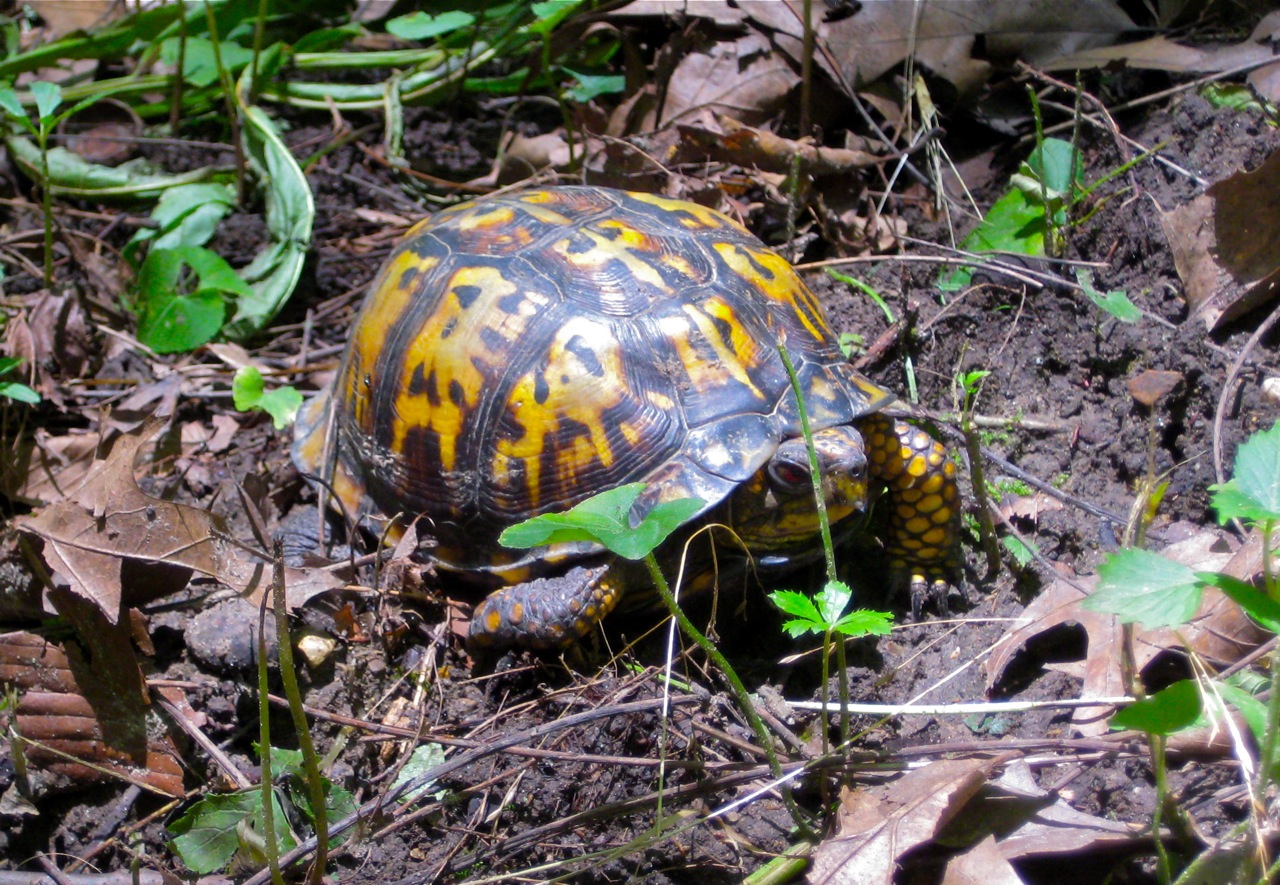
There’s quite a bit of wildlife in and around Forest Glen. In trips past we’ve seen owls, several kinds of woodpeckers, turkeys, vultures, pheasants, and deer. We saw several of those this trip as well, but we also saw something that was common when I was a boy, but has been quite rare in my experience for more than twenty years: a box turtle.
Box turtle just off the path at Forest Glen.
Apparently the Forest Glen box turtle population has been at some risk—a few years ago, tens of box turtles were found dead, all in the same area. They’ve done quite a bit of research on what happened without a definitive result, but the best guess is that some infectious disease took them, possibly passed to many individuals when a large number of turtles were caught and then held together for a local charity event that included a turtle race.
Apparently the local organizers have agreed to drop the turtle race, as a way to protect the turtles. (The race had been held for 49 years without incident, but so many dead turtles all at once was a strong sign that there was a problem.)
A great hike, albeit a bit tiring, and some very pleasant (albeit a bit brief) socializing after. Here’s the details on Endomondo:
If you’re familiar with Forest Glen, it might look as though we hiked the backpacking trail, but we didn’t—because that would have been against the rules, which require that you register a week in advance and pay a fee. Instead, what we did is scout several segments (well, all the segments) of the backpacking trail in advance of some future hike. Before trying this trail with a backpack full of camping gear, we thought it would best to know just how rugged it was and how hard it was to follow the markings. (And it’s good that we did. Our urban walking has not quite conditioned us adequately to manage this trail safely with camping gear. We’d have almost certainly made it, but several spots would have been tough—maybe even dangerous—if we’d been carrying heavy packs. Also, we did miss one turn. By the time we’d backtracked and gotten back on the trail, we’d added a good half a mile to our total distance.)
My sore calf never hurt throughout the hike, although I could just perceive the injured spot as slightly tight, slightly tender on some of the more aggressive downhill bits of the hike.
Tomorrow will be a rest day. If today’s activities don’t produce any soreness, maybe I’ll try a short run on Monday.